My adventures in San Diego included eating at Mexican restaurant. Me! By myself! Those who know me know I run at the first sign of a hot spice. Imagine how brave I felt entering a Mexican restaurant and ordering a chimichanga! I loved it and the refried beans and Spanish rice.
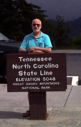
But I really wanted to tell you about Old Town. It's a State historic Park which tries to preserve the original Spanish settlement of San Diego. The mission was moved within a couple of years of its founding to get away from the soldiers and near to where the Indians lived. I visited the mission church took a few pictures. The original priests room is preserved and I took a couple of pictures to show its simplicity. The church and its related buildings were made of adobe with walls about 4 feet thick. I've been pondering the reason for this thickness and I've decided it's because Adobe bricks are quite weak and the thickness is needed to support the roof. The choir loft is reached by an outside staircase. The nave of the Church is long and narrow. The only doors are opposite each other approximately halfway down the nave.
Old Town was very interesting. The most important building in the town was the residence
of the Commandant. It was a U-shaped building with each role opening onto a covered porch or walkway. The outside walls of a U-shaped building were continued to enclose a courtyard. in the courtyard was a southwestern part with desert plants at a couple of fruit trees. The ceilings of Rome's were wooden boards, like a floor. They were supported by thieves which were lashed together with what looked like rawhide as opposed to wooden pins that I'm familiar with. The floors were what I would call raw tile approximately 6" x 12". I was surprised at the quality of the furnishings that had to stop and realize that this was the home of a wealthy man with access to imported furniture. This hacienda sat at the head of the square to merchant buildings and government buildings surrounded the other three sides.
I was fascinated by the barn contents on display are just off the square. the barn was used as a Museum to display an interesting variety of transportation related items. For instance, there was a very crude cart, well warn, with appeals eight out of treetrunk layers so you've got the growth rates going around the wheel and wearing off the wheel. That is a large display about Concord coaches including a poster showing a shipment of a hundred or so coaches out of the city of Concord on the railroad. There was a Wells Fargo Concord coach and a lighter version of the Concord coach also made in Concord New Hampshire. I'd never seen this lighter version. Rounding a corner, I came upon a wagon with the manufacturer's name in large letters: Studebaker. Definitely the oldest one I'd ever see!
I spent the most time in the barn on the tandem wagons. I thought that tandem trailers were a modern invention and one I don't like to meet on the highway. However these freight wagons from the 1800's were on display here in Old Town. the explanation given was that 18 mule teams were used to haul freight. The driver rode the left mule nearest the wagon and steered by a rope hitched to the front left mule. This mule with a strained to turn left in response to a continuous pull on the rope and to turn right in response to a series of pulls. Multiple teams of oxen were also used to pull these tandem wagons. I decided that there had to be a reason for tandem wagons and I've decided it was because of the shortage of manpower. This way one driver could carry a double load. Whether you used oxen or mules depended on speed and feed. Mules moved at 2 and 1/2 mph. Oxen at 2 mph! Mules had to carry their food but oxen could graze. Just keep that in mind the next time you move ! Pics here.
Showing posts with label Calilfornia. Show all posts
Showing posts with label Calilfornia. Show all posts
Saturday, November 10, 2007
Wednesday, November 7, 2007
San Diego -- Balboa Park
This subject is a big one since it took me two days to see everything I wanted to see. The park is unlike anything I have ever seen. It is huge, like Central Park but with canyons and ravines running through it. In the early 1900s, the city set aside this large piece of land. It was used for the Pan American exposition which celebrated the opening of the Panama Canal. Many of the buildings in the park were built at that time. They now house 13 museums. One of the activities highly recommended was a visit to the extensive Rose Garden. I crossed over the bridge to do this and was sidetracked by what I would call a Southwestern Garden. I had heard that my niece, Kristi, loved cacti and I started out taking a few pictures for her. Then I got to thinking as I walked through this garden that it probably was the unique garden. Certainly nowhere in New England would one find a cacti garden! Furthermore, I've been preaching and really feeling, and very strongly about the waste of water that I see here in the Southwest. So, a desert garden fit with my prejudices. Anyway, look at the pics!
Another little sidetrack. As I was waiting for the tour bus to take me back downtown, I came upon the longest limo I've ever seen. As I walked by it, I asked the driver if it was for the bridal party I could see having pictures taken in the amphitheater. And he said that it was for a different bridal party than the one I could see. He told me that car was 30 feet long and asked if I'd like to look in it. Look at the pics! There were at least five bridal parties having pictures taken at the same time. At least it wasn't completely like a Moon Church wedding.
At the far end of the park, a local merchant had built an Arts and Crafts style mansion which has been given to the city. I toured the mansion and tried to take pictures outside. I really only caught a door and window that I thought were worth saving. My impression of the house, beyond the fact that I would have loved to live there, was Frank Lloyd Wright! I didn't know that much of his style fit in The Arts and Crafts school of architecture. I thought he had invented his own called to Prairie Style. I have seen a number of right houses including those he called Usonian. This house, the Marston mansion, had a great deal of woodwork. In some ways it made me think about post-and beam house where the beams were covered with finished wood. Every room had wainscoting. Both the doors and windows had a lot of glass but had vertical strips of wood dividing the glass. The floors in the public spaces were oak and each room had a border of oak flooring and then the regular oak boards in the center of the frame. The nonpublic rooms were floored in hemlock. Most every room had built in cabinets with wooden doors. The furniture in the living room was Stickley. The sitting room upstairs was furnished in Wicker and we were told that the Wicker which used to make the room feel lighter. The outside of the house was brick. It really was very attractive but I like Frank Lloyd Wright buildings. He did not design this but it felt like he could have.
I went to the San Diego zoo which is also in Balboa Park. I took some pics, mostly of animals I was unfamiliar with. While on the tour bus, we went by a section of the park labeled Kopje. Each time we passed it, I asked myself what kind of animal that could be. When I left the bus back and entered that section. Dummy!! Kopje is a South African Boer word pronounced copy and means little head. It's a little pile of rocks in which animals live. In this rock pile, there were the cutest little klipspringers (cliffspringer's). They can jump from a standing start 10 feet. They use this ability to escape from predators by jumping from rock to rock. I have to admit that the zoo didn't thrill me. Okay but not unique like I expected.
Something that did really thrill me was a Japanese garden in Balboa Park. I called my daughter-in-law, Krista, to talk about the loggia. It was unique. Over a post-and beam frame, a crosshatch of bamboo pieces were lashed together. Vines had been trained to climb over the bamboo. Beautiful. Simple. Eco friendly! the rate stone in the rock garden was just as simple and beautiful. The theme throughout the garden seemed to be water running slowly through bamboo. It was a bamboo piece that dripped of water into a piece of bamboo wage Winfield tipped over and dumped out the water. Unphotographable! of their bamboo fountains dripped water into the stone pots or simply to rein in a slight stream of water continuously. Somehow not one photograph came out. But I loved every bit of it.
Tuesday, November 6, 2007
San Diego -- Harbor
I began my visit to San Diego at the harbor. Not only is the visitors center located there, but there are so many ships along the Embarcadero that they demand attention. The largest were the cruise ships including a couple of Princess line. I cannot imagine getting on one of those with thousands of other people. I went south along the Embarcadero to see the USS Midway, an aircraft carrier now docked permanently as a Museum in San Diego. There were 60 stations where you pressed the number on the telephone like piece to listen to an explanation of what you are seeing. In addition there seemed to be hundreds of Navy veterans volunteering as docents to answer any question you could think of. They also demonstrated certain aspects of the ship and took small groups through the island (I think that's what the tower is called). In that tower, after walking at least three flights of stairs, we toured the air boss control room which looks out over the flight deck and the bridge which controls the sailing of the ship. We were a group of about 20 and packed in these places. However, it was below deck where sardine packing was normal. I cannot imagine how the enlisted men existed for months at a time in the spaces. I guess I was lucky to go in the Army!
I hadn't realized that the off-center flight deck (which was invented by the British) was just for landing and the on center deck with its catapults was for takeoffs. Our guide stressed how separating these two functions made life so much safer for the pilots. On the deck, they had examples of the various types of aircraft which had flown from the Midway during her service. I also toured the hangar deck and the huge elevator which carried the planes from the hangar deck to the flight deck and back. All in all, a most instructive and interesting afternoon. I highly recommend it. Some pics here.
Also in the harbor is the San Diego Maritime Museum. They have a variety of craft you can tour with experienced seamen to answer questions. I was particularly taken with the Star of India and the HMS Surprise. The Star of India was one of the last sailing ships built in England. She sailed around the world 22 times mostly carrying immigrants to New Zealand. I found it interesting for a number of reasons including the fact that she is an iron hulled vessel. Built just before the age of steel, her hall is entirely of iron and is a perfect copy of a wooden hull sailing ship. She has iron beams exactly where there would be wooden beams. The thickness of her siding is exactly the thickness of a wooden siding. She is technically a barque. This means that the foremast and the mainmast are really with square sails wound which run perpendicular to the keel. The mizzenmast (one nearest the rear) is rigged with sails which run parallel with the keel. (See how much you can learn from a docent). Anyway, Museum volunteers were having a dress rehearsal in preparation for sailing up and down the coast this coming weekend. The ship is crewed by all volunteers except the captain who is a professional. Crew members are required to train twice a month for a year before they are allowed to join the crew. I found the practice shifting of the sails unbelievably instructive. When I taught my eighth graders about whaling (way back when), I could've used what I learned about rigging. Finally, standing rigging (those ropes which hold up the mast) and running rigging (those ropes which move the sails) are clear in my mind.
Below decks, I found the accommodations terrible. First-class passengers were required to furnish their own cabins. These cabins were about 6' x 8' and an entire family was expected to fit in there. Their meals were taken in a large common room with the officers. I think the room would seat eight to 10 people. The captain's cabin was about the same size as the first-class cabins. In the hold, where the sleeping spaces of the rest of the immigrants. There were six bunks in each space, some of the bunks were doubles. It appeared that they lived in their bunks.
The other ship I liked was the HMS Surprise, the one used in the movie Captains and Commanders (or some such title). My son Erik has read all 22 books in which the Surprise played an important part. I think I've read most of them. Anyway, I just had to call him while I was aboard! The Surprise is technically rigged as a ship, all three masts with square sails perpendicular to the keel. She is a small fighting ship (frigate) with cannon as her armament. It takes a crew of about 30 to sail her but another 170 to fight her. She is about 135 feet long and 32 feet wide on the deck. Erik asked about the space between the top deck and the fighting deck which turned out to be approximately 5 feet. Anyway, I feel like I have seen what I only imagined as I read the books. pics here.
Saturday, October 13, 2007
Southern California
We went south from Laurel Bay on US 101 and California 1. Escape is part of the trip on the coast and part inland. We chose the inland route 101 in order to go to a town called Solvang which was founded by a group of Danish settlers in 1911. The settlers have worked very hard to keep that Danish flavor of the downtown section. The buildings are primarily half timber with stucco or decorative brick work between the exposed beams. There are a lot of towers, especially clock towers. The roofs are a variety of substances in an attempt to look like thatch. There were flat tiles which had moss growing on them. There were wood shakes. But mostly, there were wooden shingles width three points instead of a squared and these were laid in such a way as to, at first glance, make you think you are seeing thatch. Many roofs had stork figures. Some roofs had crossed wooden pieces at the ridge line, again as a real thatch roof would. The most impressive part of the town was four bakeries! we went into three before being overcome by the fantastic aromas in the third one. There we bought a special dessert for our lunch.
South of Solvang, we went back to the coast. Off the coast of Santa Barbara County, we saw a bit least nine offshore oil rigs. This beautiful coastline is ever in danger of an oil slick but the people on Cape Cod are worried about unsightly windmills. I wonder if they'd give up their use of oil in order to prevent the building of the windmills.
We drove through part of Santa Barbara because the AAA book highly recommended the mission and the county courthouse. We were in the RV and traffic was horrendous. Mike took one look at Mission Road, narrow, cars parked on both sides and an impossible corner. We went on. I asked a man of the bicycle if he knew where the county courthouse was. He said the next light, on the left but no left turn allowed there. Mike drove on until we could get back to the freeway (not highway, not interstate, but freeway in California). We camped one more night on the California coast north of LA, crossed L. A. in horrendous traffic, and camped just north of San Diego. We turned east on I 8and across three sets of mountains to the desert in Southern California. These mountains were the weirdest thing I've ever seen. From a distance, they looked like some huge being had scattered boulders all over them. You could see the rock standing out from the mountain. As we got closer, you could see that some of what looked like boulders were still attached to the ledge that they were eroding from. Some of the boulders seem totally free and ready to roll down and in a moment. Further into these mountains, Peggy said they look like heaps of rock created by dump trucks. She was so right. The last of the mountains were like the first with boulders and soil. I'm searching for the name of these mountains. Incidentally, on I 8, we went from sea level to 4000 feet in the first hour! I can't find the name of the mountains that straddle I-* in Southern California. Help!
We came into the desert near town called Octillo. Shortly thereafter I asked Peggy what kind of cactus was growing there and she said octillo! It looks like an upside down octopus. Near the border, I could see the outline of major mountains to the north. At their base was a pink undulating strip. After many miles, we get close enough to see that the pink strip was really and dunes. sent in an area and a number of camping sites with campers in circles and dune buggies behind or beside each camper. These buggies were the size of small cars and I was told they fill the dunes on the weekends. on the small dirt roads running beside I 8 were border patrol cars at intervals. We were only a few miles from the Mexican border.
I've noticed in southern California and here in Arizona that there are very long bridges over dry river beds. These riverbeds are as applied as the Mississippi. It makes you realize how flat the country is and how wide the streams spread when there is water.
We're here in Yuma Arizona for a month. I'm not sure what I'll be blogging about. However, a first observation. It was about 90 the first afternoon and we went swimming. The pool was tepid. But when I got out, within it seemed like seconds, my body was frozen wherever my wet bathing suit touched. I think it has to do with the dryness of the air which immediately sucks the moisture away. Anyway, I've adopted a new tactic and change out of my wet suit before walking home! I'm sure I'll have more to say about dry heat as I go along.
Friday, October 5, 2007
Morro Bay
We left Madera and climbed over the mountains to the coast, Morro Bay. We went down Route 99 which runs through the center of the state and onto route 41. An interesting sign at the beginning of 41 said trucks RVs vehicles with trailers are not to use this road for the next 25 miles. We switched over to Route 46 which went through some mountains, then route 101 South to 41 and then 41 over the last of the mountains to the coast. My California map shows mountains north and south of Morro Bay but let me tell you, they're here too!
As we came into Morro Bay, we passed a large gumdrop shaped rock (mountain?). There is another just outside our campsite. The biggest one is in the Bay. I found out there are nine of these cores of old volcanoes in a line across this county. The 10th is north of Morro rock hidden under the ocean. Until 1969, Morro rock was quarried for its granite. Now there's a causeway at the north end of town where you can drive out to the rock. We walked around the rock to watch the ocean waves splashing against its base on the West side. A native told us how high the winter waves reach against the rock. Most impressive. The town is small, about 10, 000, and most of the houses are east of Route 1, climbing the hill side, each with a view of the bay.
We went north along the coast yesterday. Our goal was to see Hearst Castle at San Simeon. I really don't know what to say about that. It was too large for me to grasp. In fact, I didn't take any pictures and neither did my photographer. You couldn't use flash in any of the buildings and the outside was too large to frame. But let me tell you a little about what I saw. It seems bigger than life. And yet, this is how one man lived. He actually moved in to each of the guest houses as it was completed. He started using this compound while it was still building around him. In fact, he rebuilt the swimming pool three times while he lived there. Remember, he was very conscious of the California earthquakes, so he built all the structures using reinforced concrete. When he changed his mind, the reinforced concrete had to be removed before anything new could be built there. We went up 150 steps from the tour bus site. Incidentally, we rode the tour bus 5 miles across the Hearst Corporation ranch to get to the house. Anyway, the hundred and 50 steps were broken up into several flights of stairs, most of them curving from one landing to the next. On one of the landings was the largest pool I think I've ever seen, surrounded by classical columns and pediments. Then one flight up further to the Plaza (?) outside the front door. This was some entrance. The door was at least two stories high and wide enough for an elephant, had a fountain big enough to swim in with marble benches in a graceful curve around the outside. Probably seating for a hundred. Inside, we went through a few of the main rooms. The first was the great room used for cocktails before dinner. It was probably 25 x 50 feet and I would estimate 30 feet high. The outside walls were wainscoted in several hundred-year-old church seats. When I think of the Gothic churches of Europe or Westminster Abby that I've seen on TV, between the congregation and the high altar along the sides are stalls with high wooden backs and seats with little arms all carved out of wood. These were used as wainscoting in this room. The ceiling was one found in a Mediterranean Castle and brought over whole. It wasn't large enough for the room, so skilled craftsmen added to it in such a way that you cannot tell where the old ends of the new begins. This seemed to be his attitude toward all the antiques he bought in Europe. Use them. We went through some bedrooms in one of the guest houses. Each room was filled with antiques and each was used by whatever guest was assigned there for the weekend. He average 50 to 80 guests each weekend. The views from the terraces were fantastic. He looked out across a rolling brown hills to San Simeon Bay. All in all, I think I need to return to San Simeon. I just haven't grasped it.
We went further north along the coast and saw a couple of beaches and filled with elephant seals. These were juveniles who were there awaiting the arrival of the adults who winter here. There was a docent from the group protecting these seals. He was helpful in explaining what we were seeing. Even further north, we came to a place called Ragged Point. Peggy took some wonderful photographs. Suddenly at this point, the coast changed from beaches and some low cliffs to rugged mountain sides flush against the surf. I'm not sure that I ever saw this in real life before. I kept asking Peggy to take more photos both north and south.
Today, we went to San Luis Obispo. The mission there is still a functioning church. The walls are very thick and have signs saying not an earthquake proofed building. At one time, the church had been refurbished to look like a New England church. It has now been returned to as close to its original decoration and format as possible. The Stations of the Cross were primitive paintings as were many of the decorations which were done in very bright colors. The church itself was L-shaped and the altar was set at an angle facing neither section of the L. Outside, the church was whitewashed or the Adobe was painted white. There was a beautiful plaza in front of the church with a pergola which I photographed for my daughter-in-law.
All in all, I really enjoyed our week here in Morro Bay. I had read about the mountains along the shore in California but seeing it is much more impressive.
Tuesday, October 2, 2007
Yosemite
We left San Francisco this morning and traveled east toward Yosemite National Park. We used a variety of routes but mostly California 120 which starts in the middle of the Sacramento Valley and goes east across Yosemite. After leaving the cities (Oakland and Berkeley), we climbed up below sculptured hills which were dry and tan. We dipped down toward a dry brook which had green grass growing in its bed. The only green in a monochromatic world. We rode across the valley and saw a huge Holstein dairy farm. There must've been 500 heifers out in the fields. The cow barns were the largest I've ever seen and shaped just like those on the Audet farm in Vermont. Then groves and groves of almonds and walnuts, and even grapes. I saw a machine that appeared to be sweeping the ground under the trees. I later found out that to harvest these nuts, they shake the tree, use blowers to push all the fallen nuts into rows and then sweep them up. All done mechanically. As we left the Valley and started to climb some foothills and came upon the first California wind farm that we've seen. It was huge. There seemed to be two types of windmills. Those which looked like the ones in the Midwest with a single pole and large blades and the other which was supported on a three legged triangular shaped mast and had smaller blades. These had an interesting variation. It was a small rotor near the back of the head which looked very much like the rear rotor on a helicopter. Maybe has the same function which is to counter the rotational effect of the large blades. Who knows?
A little higher into the foothills we suddenly came on fields full of rocks. Like there had been an explosion and the rock from the explosion had scattered far and wide across the fields. I know that's about the opposite of what happened. These hills have eroded down to sedimentary rock which is harder than whatever was surrounding it so the rocks are showing above the dead dry grass. Some of the fields looked like headstones in a cemetery. I think the rock stands sometimes four to 6 feet high and the slabs of rock are about 6 inches thick and varying from two to 4 feet wide and stand in the fields just like in a cemetery. I think the rock is shale or slate. But the layers have been turned on their side so that instead of horizontal you are getting these vertical pieces sticking up above the surrounding ground. At one place was a long ridge of it, looking very much like a stone wall in New England.
I've decided that the one word that best describes the West is water. The lack of water creates a very dry climate where hardly anything grows. The land is brown and dry and barren. Then, the opposite extreme occurs. Too much water for the land to absorb falls on it in a short period of time and you get tremendous water erosion. The softer, weaker rock and ground is washed away leaving dramatic gullies and dry watercourses cut deep into the earth. Lastly, to make the land productive, huge amounts of irrigation have been introduced. No one knows the long-term effects of this irrigation. Are we tapping the aquifers and draining them? We do know that long-term irrigation deposits huge amounts of salts into the ground and makes it totally unproductive for long periods of time. Do we really know we're doing?
We spent a couple of days in Yosemite National Park. The Park is part of the Sierra Nevada chain which has been described to us as a 400-mile long block of uplifted granite. We went to Glacier Point which is 3100 feet above the Yosemite Valley. This valley was formed by the runoff from glacial melt. This is a totally new idea for me. I always knew that rivers cut through mountains but I never thought about those rivers being fed by melting glaciers. Glaciers also contributed to the shape of the mountains in the Sierra Nevada’s. The glaciers covered the tops of some mountains and their movement rounded the top of these mountains. Those mountains in the chain with pointed tops were above the glaciers. At present, there is a river flowing through the valley called the Merced River. Anyway, glacier point is a fantastic overlook. I’m sure I never looked straight down 3100 feet. I assure you, I held on tight! Peggy took the picture to prove I was there.
My favorite place in the park was glacier point but driving through the valley impressed me especially looking up at those rock formations I had looked across at from glacier point. Half Dome and other huge cliffs were perhaps more impressive from the bottom. Of course, El Capitan was overwhelming. There are plenty of pics of all of this. A thought occurred to me as I was looking at all that granite. When I visited the Rock of Ages quarry in Barre, Vermont, I learned that Barre is sitting on a granite dome that is some 10 by 30 miles and 10 miles deep. Imagine how much granite they could dig out of the Sierra Nevada’s.
We also visited the Mariposa Grove of Giant Sequoias. This grove is at the southern end of the Park, about 30 miles south of Yosemite Valley. I had seen the California coast redwoods earlier on this trip. It doesn’t seem possible, but these actually seemed bigger. They are said to be shorter, by about 30 feet, but they are clearly wider. Walking around the one called the grizzly giant made me realize just how huge they are. Of course, I had to have my picture taken inside the tunnel tree. At one point in history, there were two tunnel trees but one died due to the tunnel and this one is expected to follow.
The altitude in this area was so varied that I’m not sure I can explain it. We left the Central Valley of California and went to about 3000 feet in the RV. About 2000 of those feet were in one hill. We followed Route 120 out of the Valley and up this hill. We had planned to use Route 140 but mudslides closed the road. On 120 that hill was called New Priest Road. As we were leaving, we spotted Old Priest Road. Thank God they built the new one! Our route was longer but more gradual. The road clung to the mountain from which it was cut. The sheer drop to my right as we climbed (without guardrails, of course) scared the ___ out of me! Coming down was much easier (I was on the inside)! So, we camped at about 2800 feet, drove into the Park losing and regaining that altitude three times. The highest point we were at in the park was 6000 feet.
When we left Yosemite, we came back down to the Central Valley, called the San Joaquin Valley at about 100 feet of altitude. The valley is as flat as a pancake and you can see in every direction. The Sierra Nevada’s are all to the East of the Valley and feed three rivers into this area, the Merced, the Tuolumne, and the Chowchilla. Since about 1900, these rivers have been tapped by state organized irrigation projects to turn this dry valley into a productive paradise. The irrigation starts as cement canals leading water away from the rivers and out to a network of fields. From there, a variety of methods are used to spread the water on the fields. I saw huge dairy farms, the largest I’ve ever seen, with pole barn structures for the dairy cattle. These structures have no sides, a raised central section (I assume for ventilation) and two shed like rooves slanting down from the raised central section. The fields near the farm were corn (already cut down and I assume chopped but I saw no silos) and alfalfa, much of which had been cut and was laying in windrows. I assume it was going to be bailed, and not chopped as we would in New England. Keep in mind that all these fields, including the pasturage for the younger stock, were irrigated. I wonder how much irrigation can take place before the salts left from irrigation ruin the land.
We stayed three days here in Madera, which is just south of Stockton. Beautiful warm days and cool nights! We’re off to Moro Bay tomorrow. I will get to see the famous, or is it infamous, Hearst Castle!
Tuesday, September 25, 2007
San Francisco II
A critic advised me that I had skipped a number of interesting things in my San Francisco last day blog. Unfortunately, she's right. I got lazy and decided not to rig up the microphone and just type a few thoughts. Now I know why I bought this dictating program. I'm too lazy to type! By the way, yesterday's blog said Marin Heights with the correct name is Marin Highlands. Also, I failed to mention that San Quentin prison is within miles of this place where we're camping. We went by at on the ferry.
So , about yesterday. We sort of wandered through the city to see those places on my list which were not crossed off yet. We started with another cable car ride to the famous crooked street, Lombard Street. I was a little disappointed but glad I saw it. Then we found, with the help of a native, the Italian section. We came upon a pretty little park with a band playing, a crowd watching, mounted policemen patrolling, and to classic MG's -- the old square cut type with right-hand drive. Beautiful! Just up the street, we found the U.S. restaurant which had been recommended. We had a (is divine an adjective for food?) meal. Stuffed is what we were. The waitress, who was clearly the boss, the hostess, the organizer, offered pasta with the dinners. Peggy said she'd take anything. When the waitress offered the same thing to Mike, he asked like what? We were all shocked to hear not just penne and spaghetti, but ravioli. They both ordered ravioli which turned out to be the restaurant's specialty. Hand stuffed with meat and spinach and cheese! Damn, I should've ordered that! But I had my fettuccine Alfredo with chicken. It was just as good!
Then we managed to find a cable car to take us to Chinatown again. Some one of the books I had researched said be sure to go to this alley where the Chinese fortune cookie factory was. We found it with the help of the city delivery postal worker! It was great to see how fortune cookies are made. The thin wafers are on a conveyor system held vertically as they come out of the oven. The worker talks one hot way for off the conveyor, picks up a fortune slip, holds it against the way for which she drapes over a horizontal metal pin. The wafer is still pliable and droops down over the pin and gets a quick pinch from the operator. And on to the next one. I, of course, couldn't resist the almond cookies also made at that bakery. They are delicious. It went on from there to the oldest cathedral in San Francisco, St. Mary's, which is located on the corner of Chinatown.
We then took my favorite form of transportation down to the Embarcadero. I simply can't tell you how much I enjoy riding on the left running board of the cable car. I don't know if it's because I get a thrill out of being able to ride such a thing up and down those steep hills, without a panic pill. After all, it's the closest I'll ever get to a roller coaster! I just love meeting a cable car going the opposite direction. You pass within inches of the people coming at you. I was wearing a backpack and if I hadn't turned it will people on the left side of the oncoming cable car. Maybe I'm turning into a thrill seeker in my old age. Do you think that's possible?
Today we drove south from Marin County, across the Golden gate Bridge, south across San Francisco and onto Route 1. This is the Coast Highway. We followed it for about 30 miles south. One of the first things that caught my attention when large signs saying Pumpkins,U Pick Strawberries, Corn Maze. Imagine those three crops available to the public on the same day. We saw lots of truck farm fields including one filled with cabbage like plants, Brussels sprouts?
We stopped at Pompanio State Beach. Gorgeous breakers, beautiful sand, me in the water. I just had to get a toe into the Pacific! I succeeded and then Peggy said I needed proof, a picture. I went back in, turned toward Peggy, and was swamped above my knees by breaking wave. Much warmer than Maine in August. In fact, look at the pics. Those after my dunking are from this trip. Another unforgettable day. I am so lucky.
Sunday, September 23, 2007
San Francisco
Thanks to my friend Dottie, I now know that the flower I saw on the coast road near Klamath was foxglove.
We left the Eureka area and traveled south on Route 101 over the same 60 miles we had toured in the car the previous day. It is amazing how different the perspective is when you're sitting high in an RV looking out of a picture window sized windshield.At one point, we passed a sign I hadn't even seen the previous day. It was higher than my head in the RV and showed the high water mark in the 1964 flood. At that point the river was 30 or 40 feet below us. That Eel River flows north alongside 101 through the Redwood Forest. It winds through a channel it has cut and the road winds with it and across it a hundred times. I wish I had counted the bridges over the Eel. These bridges were extraordinarily high. In the Park we read about the floods and discovered that the bridges had been washed out in the flood and so were rebuilt higher. The funny thing is they were rebuilt only 2 feet higher! In 1964 they received 101 inches of rain. The average rainfall is 51 inches. That might explain the flooding.
We were driving through Mendocino County, still on 101, when suddenly we were in the middle of the largest grape fields I've ever seen. On this trip I've seen endless fields of corn, of wheat, of hay, and now of grapes. Mike spotted trailer truck loads of bright red grapes. We continued with the vineyards into Sonoma County. I discovered this is called the Russian River Valley. The vineyards went up the hills on the sides of the Valley to a certain elevation and stopped abruptly. If the hill was low, the vineyards went right over the top. A little further down the valley I saw a sign, "U Pick, Sweet Juicy Strawberries". This was on September 19, 2007.
We camped just off 101 in Marin County, just north of the Golden Gate Bridge. The f irst day I ventured into the city by bus to go to the VA. Not knowing the system, I crossed the city by bus four times that afternoon! It took one hour each way but I followed each trip carefully on the map and learned how the city is set up. As I left the city to return to the RV park, I was crossing the Golden gate Bridge at 7 p.m.. Looking back toward San Francisco, I realized it's a white city. Almost all the buildings are white or very light. Here and there, lights were beginning to come on and sparkle in the twilight. Northeast, across the bay, the sunlight was reflecting off windows in the Oakland/Berkeley area. A huge sailboat was proceeding away from me into the bay. Alcatraz sat square in the middle with a ferry boat passing on each side and another across the front. I Fell In Love!!
The next day, we took a tour of the city. The guide was entertaining and informative. He took us all around but I especially enjoyed the view from Twin Peaks and from the Marin side of the Golden Gate Bridge. He dropped us off on Market Street where we took a bus to Haight-Ashbury. Then we rode the cable car! It was like an amusement park ride! I rode on the running board in the front position while we climbed a hill and then went down the other side. I liked it so much, I insisted we get right back on going the other way! We ate in Chinatown and then rode another cable car. To cap the evening, we rode one of the old-fashioned electric streetcars around the Embarcadero. What a city! Tomorrow, I have to try the ferry service across the Bay.
Today we drove to Marin Highlands. These are high bluffs just West of the Golden Gate Bridge. The views across the Bay and into San Francisco were unmatchable. I'm sure the pics don't touch it, but look anyway.
Went in by ferry today. It was too fast a trip! Saw the bridges, Alcatraz, and the piers. Rode the cable car again (twice more), saw more of the city and said good bye on the Bridge! Sad to leave but onward!!
We left the Eureka area and traveled south on Route 101 over the same 60 miles we had toured in the car the previous day. It is amazing how different the perspective is when you're sitting high in an RV looking out of a picture window sized windshield.At one point, we passed a sign I hadn't even seen the previous day. It was higher than my head in the RV and showed the high water mark in the 1964 flood. At that point the river was 30 or 40 feet below us. That Eel River flows north alongside 101 through the Redwood Forest. It winds through a channel it has cut and the road winds with it and across it a hundred times. I wish I had counted the bridges over the Eel. These bridges were extraordinarily high. In the Park we read about the floods and discovered that the bridges had been washed out in the flood and so were rebuilt higher. The funny thing is they were rebuilt only 2 feet higher! In 1964 they received 101 inches of rain. The average rainfall is 51 inches. That might explain the flooding.
We were driving through Mendocino County, still on 101, when suddenly we were in the middle of the largest grape fields I've ever seen. On this trip I've seen endless fields of corn, of wheat, of hay, and now of grapes. Mike spotted trailer truck loads of bright red grapes. We continued with the vineyards into Sonoma County. I discovered this is called the Russian River Valley. The vineyards went up the hills on the sides of the Valley to a certain elevation and stopped abruptly. If the hill was low, the vineyards went right over the top. A little further down the valley I saw a sign, "U Pick, Sweet Juicy Strawberries". This was on September 19, 2007.
We camped just off 101 in Marin County, just north of the Golden Gate Bridge. The f
 irst day I ventured into the city by bus to go to the VA. Not knowing the system, I crossed the city by bus four times that afternoon! It took one hour each way but I followed each trip carefully on the map and learned how the city is set up. As I left the city to return to the RV park, I was crossing the Golden gate Bridge at 7 p.m.. Looking back toward San Francisco, I realized it's a white city. Almost all the buildings are white or very light. Here and there, lights were beginning to come on and sparkle in the twilight. Northeast, across the bay, the sunlight was reflecting off windows in the Oakland/Berkeley area. A huge sailboat was proceeding away from me into the bay. Alcatraz sat square in the middle with a ferry boat passing on each side and another across the front. I Fell In Love!!
The next day, we took a tour of the city. The guide was entertaining and informative. He took us all around but I especially enjoyed the view from Twin Peaks and from the Marin side of the Golden Gate Bridge. He dropped us off on Market Street where we took a bus to Haight-Ashbury. Then we rode the cable car! It was like an amusement park ride! I rode on the running board in the front position while we climbed a hill and then went down the other side. I liked it so much, I insisted we get right back on going the other way! We ate in Chinatown and then rode another cable car. To cap the evening, we rode one of the old-fashioned electric streetcars around the Embarcadero. What a city! Tomorrow, I have to try the ferry service across the Bay.
Today we drove to Marin Highlands. These are high bluffs just West of the Golden Gate Bridge. The views across the Bay and into San Francisco were unmatchable. I'm sure the pics don't touch it, but look anyway.
Went in by ferry today. It was too fast a trip! Saw the bridges, Alcatraz, and the piers. Rode the cable car again (twice more), saw more of the city and said good bye on the Bridge! Sad to leave but onward!!
Wednesday, September 19, 2007
Coast and Redwoods
California Coast
We left Redding in the morning when it was about 60°. This was the high point on the thermometer for the day. We went west on Route 299 toward Arcata and Eureka on the northern California coast. It was only about 120 miles but it was the worst road we’ve traveled in the RV. We climbed out of Redding and into the Trinity Alps. This north-south mountain chain is probably part of the Cascade Mountains. We started at about 500 feet altitude climbing to 3000 feet, dropped back down to 1800 feet, climbed to 3500 feet, dropped back down to 1800 feet. Then we climbed the coastal mountain range before coming down to sea level at Arcata. Twice we came to warning signs saying 7% downgrade next 7 miles. Not the type of road Mike likes to take the RV on.
In addition to climbing at least three ridges, we followed the Trinity River through the Trinity Alps. This river flows west toward the Coast Range and has cut its way through sandstone mountains. The route twists and turns along the bank of the river through a narrow gulch. It’s really just wide enough for the river but a road has been cut into one side and then the other side, right out of the side of the mountains. The river is full of rock like the White River but the narrow valley reminds me of the Black River between Downers Corners and Proctorsville in Vermont. Sometimes, we climbed high above the river but still followed the twists and turns the valley. It was beautiful but sometimes a little scary with its precipitous drops.
As soon as we arrived in Arcata, Mike and Peggy took me to Trinidad. A little town set in a pretty little cove. I saw something unique there. It was a trolley car connected to a winch that used gravity to back down a railed incline into the ocean. A boat would move over the trolley car, the driver would grab onto a pole sticking up out of the water from the trolley car, and the winch would pull the car up the incline. As the car came out of the water, the boat would settle on it. At the top of the incline, an overhead electric hoist would lift the boat off the trolley moving it sidewards and settle it on its trailer which had been parked there. Truly a unique way to get a fishing boat out of water.
As soon as we arrived in this coastal area, I started seeing these tall cattail-like waving fronds. I finally asked a lady in Trinidad who identified this as Pampas grass. I don’t know what it looks like in other seasons about they are very attractive in the wild in this season.

Yesterday another first. Redwoods! We went north along Route 101 toward Crescent City. We traveled through a couple of state Redwood forests and the national Redwood Forest. Photographs simply do not capture what I saw. I knew they were large. I knew they were tall. But somehow that knowledge meant nothing. Poor Mike. He had to stop the car every 20 feet because I wanted to take another photo. I took over a hundred of them but I am really not satisfied with them. Size. I took this pic of Peggy and Mike inside a tree but…
Height. No pic does it. Check of the pics out here.
A couple of detours off on a one brought us wonderful views of the Pacific, which drove with boulders which signs explained are being scraped off the bottom of the ocean as the Pacific plate slides under the North American plate. Makes for a beautiful coastline. While on a detour, we came upon the mouth of the Klamath River. We had seen the Klamath Lake and Klamath Falls in Oregon and now we saw the end of the river. It may have been low tide, but what we saw was a sandbar with the river following an “S” curve through it. One side of the sandbar was the river and the other side was the breaking surf. I just loved all the people on the sandbar.
We spent another day in the redwoods are wrote called Avenue of the Giants. Awesome! I cannot get enough of these trees. Of the feeling evoked when walking in a grove is like that in a cathedral. It's awe inspiring. I love to just stand in the Grove and slowly turn a 360° circle. Giants every where you look. Sometimes they're even more awe inspiring when they are laying down. A diameter is unbelievable and the length, beyond imagination.

At the visitor center I found out there are three types of redwoods. The smallest is called the Dawn Redwood.it has fine needles which make me think of baby ferns. The one I've seen most of its call the Coast Redwood. It grows from about the California border down a hundred to a hundred and 50 miles along the coast. The third kind is the Giant Sequoia. We plan to go to the Sequoia national Park just south of Yosemite soon. These pics try to show the differences in the leaves. To the right is Dawn, below is Coast and to it's right is Sequoia.


On the way back, we stopped at a couple of the coastal towns to take some pictures of Victorian homes. These towns along the north coast of California must have had their heyday in the Victorian era since they have so much of that architecture. There is a famous mansion in Eureka which has it all. I'm sure you'll agree.
The last thing I want to talk about today is the barn architecture near Arcata California.There is something unique about this design, at least to my knowledge. barn has a raid in central portion where a hay loft door opens just under the eaves for the old hayforks which were used to lift loose hay in the days before bales. and the two sides come up to the side walls of that raised section. Nowhere have I seen this except in Arcata. Could we call these craftsmen barns like we have craftsman houses?

Monday, September 10, 2007
California HERE I AM!

We spent a couple of days at Diamond Lake while we visited Crater Lake. I got up the last morning feeling happy as a lark. Mike and Peggy each noticed it. I, of course, could feel it. I've been debating whether the "high" was due to my experience the previous day at Crater Lake or was it due to the fact that I knew I'd be in California in a few hours? Honestly, California has been a dream of mine for such a long time, I really doubted I would ever get here. Anyway, I was on top of the world.
We proceeded down Route 97, through Klamath Falls and on to the border, leaving Oregon behind. I saw, on the Klamath River, a couple of big squares of logs floating down the river. Somehow, I think these are called booms. They are a large rectangle of logs hooked together with what look like chains, and the rectangle is filled with loose logs. The only thing missing from the scene was lumberjacks skipping from log to log.
We entered California still a 97, which is approximately in the middle of the state, East-West. Within a couple of miles, we passed over a good-sized hill and there was a wide valley filled with various irrigated crops. Each crop was part of a patchwork of colors and textures. Included in these crops were strawberries, flowering, not ready for picking but with some workers in the fields. Somehow, this perfectly fit my mental image of California. It surprised me. I always thought that I'd identify California with San Francisco or the beaches or something else, but crops, green and getting ready for harvest in the winter, struck me as perfect. I even saw crop- dusting (by a truck) far away across the valley. Strange, the mental images we carry.
As we were heading toward I- 5, I spotted off in the far distance, the shadow of an outline of a cone shaped mountain. The haze was obscuring a real look. In fact, the sky has remained hazy when looking off in the distance. At home, I think of the three H's, hazy, hot and humid. The last word does not apply here. Hazy, yes. Hot, yes. So hot it set a record for this area and for me.It was 103 at the airport here in Redding California yesterday!!! But back to the mountain. As we continued south, more and more of the haze cleared until, finally, we came around a corner and there, in all its glory, was Mt. Shasta. Huge, snow-covered for at least its upper third, with granite cliffs and ridges showing through the snow. Magnificent.
In my mind, I compared Mt. Shasta to Mt. Washington in New Hampshire.I guess it was the way they both stand out from their surroundings. Anyway Mount Shasta is about 8000 feet higher than Mount Washington, some 14,000 feet versus 6200. So much for comparisons.
Here in Redding, there is a fantastic architectural/engineering marvel. Peggy and Mike had been there and wanted to show me their find. My first glimpse made me think of the new bridge type I've seen in Boston and Savanna. The kind where there is a vertical support and cables running out from each side like harp strings.I was surprised when we got close enough to see the vertical support was leaning in about a 30° angle away from me and the cables stretched only on one side of the vertical. This is a walking bridge and the floo
 r of the bridge is made of glass rectangles. Note the footprints (shoe shadows) in this pic. The bridge is simply a marvel. The off vertical piece balances against the suspended floor of the bridge on a 12 inch bearing. I kept my photographer busy. See the rest of the pics here. By the way, I walked onto the bridge before I realized I was walking on glass. I quickly moved to one of the two granite stripes but Mike was insistent that I walk on glass. He also insisted I touch the first cable I came to. It was vibrating! Needless to say, I touched no others. If you're ever in Redding, you've got to see this.
From the man-made to natures way, we next visited Lassen Volcanic National Park. It is promoted as a combination of Yellowstone and Yosemite. I was very disappointed that we saw no Rangers except the one selling tickets at the gate. I had a lot of questions especially about trees that I was unable to get answered. The visitors center was closed and locked. So I'll tell you about the Park and leave you with questions I can't answer.
Prior to Mount St. Helens, Lassen was the last volcano to erupt in California, in 1915
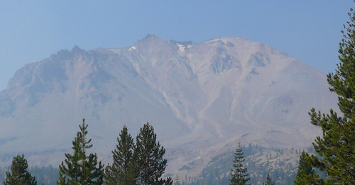 . In the picture to the right, the mountain erupted just below the center peak. Eruption blew away rock which had formed in an earlier eruption 27,000 years ago. It was a reddish hue. Multi ton rocks were carried by snow avalanches as much as 5 miles from the eruption. No one was killed but all homes in the valley were wiped out. We saw a great deal of evidence of the older rock but very little of the new rock which formed in this eruption. In the picture, the caprock on the left of the picture is of the same color as the old reddish rock.
Further into the Park we found a caldera with a small dome shaped peak in the middle. The caldera was similar to Crater Lake's but incomplete in that it was not a complete circle. Having seen Crater Lake, it was easy to piece together the parts of the caldera still showing here. It is what is left of a mountain called Brokeoff Volcano, which was the same size as Lassen before it erupted. Also in the Park we saw some fumeroles (steam vents), some boiling water pots and some sulfur spots. Not as impressive as Yellowstone but of the same type and origin. No geysers, however.
Now, trees. Lassen is an evergreen forest. The park rises from around 1000 feet altitude to over 10,000 feet at the top of Lassen Peak. We exceeded 8000. A little funny. As we were climbing up toward the high point of the road in the park, Mike and Peggy kept hearing something. As we reached about 8000 feet, there was a loud bang. Peggy was sitting in the backseat and said WOW! Mike and I both jumped. Peggy found that our unopened Lays potato chip bag had burst open alo
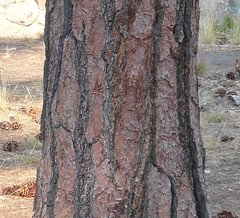 ng the top seam. It seems that Lays guarantees freshness only below 8000 feet.
Trees, that's where I was. The pic at right is of a large pine near the entrance of the park. I was particularly impressed by the pattern in the bark. The black lines are recessed and the bark has a strong three-dimensional character. In the leaflet we got at the gate, the Park service says there are Jeffrey Pines near this point. Before I read that, I was convinced these were Ponderosa Pines, based on the bark and the large pine cones lying at their base. HELP!
There were also a number of other trees which intrigued me, They were growing at various altitudes. One was a ladder-like tree. The branches seem to grow in perfect steps and exactly balanced left and right. HELP!
Then there were the trees that looked like their bark had been shredded. The bark of the tree looked stringy. I thought of Cedar but my experience with Cedar is limited to 10 or 15 foot tall trees. Of these were double or triple that.
Then I started examining the needles on these evergreens whenever we stopped. Some sort of reminded me of hemlock. The branches were flat and the twigs at the end of th
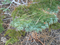 e branches spread out with short needles on each side of the twig. Another shown in this pic, made me think of Blue Spruce except only the end (new) needles were bluish and the needles were soft rather than spiky. HELP!
There, that should be enough questions. The rest of the pics are here.
Subscribe to:
Posts (Atom)