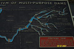
On the map of the TVA dams shown to the right, the white spot is the Montana dam. For some reason of the Alcoa dams are also on this map.
If I have my information correct, the Fontana dam is the highest in the TVA system. Interestingly, he is just about as wide at the base as it is high, around 370 feet. The spillway is a through the right-hand side of the cliff. The lake behind the dam is very low due to travel to any in the Western Carolina area.
The rest of the pics on Fontana are here